
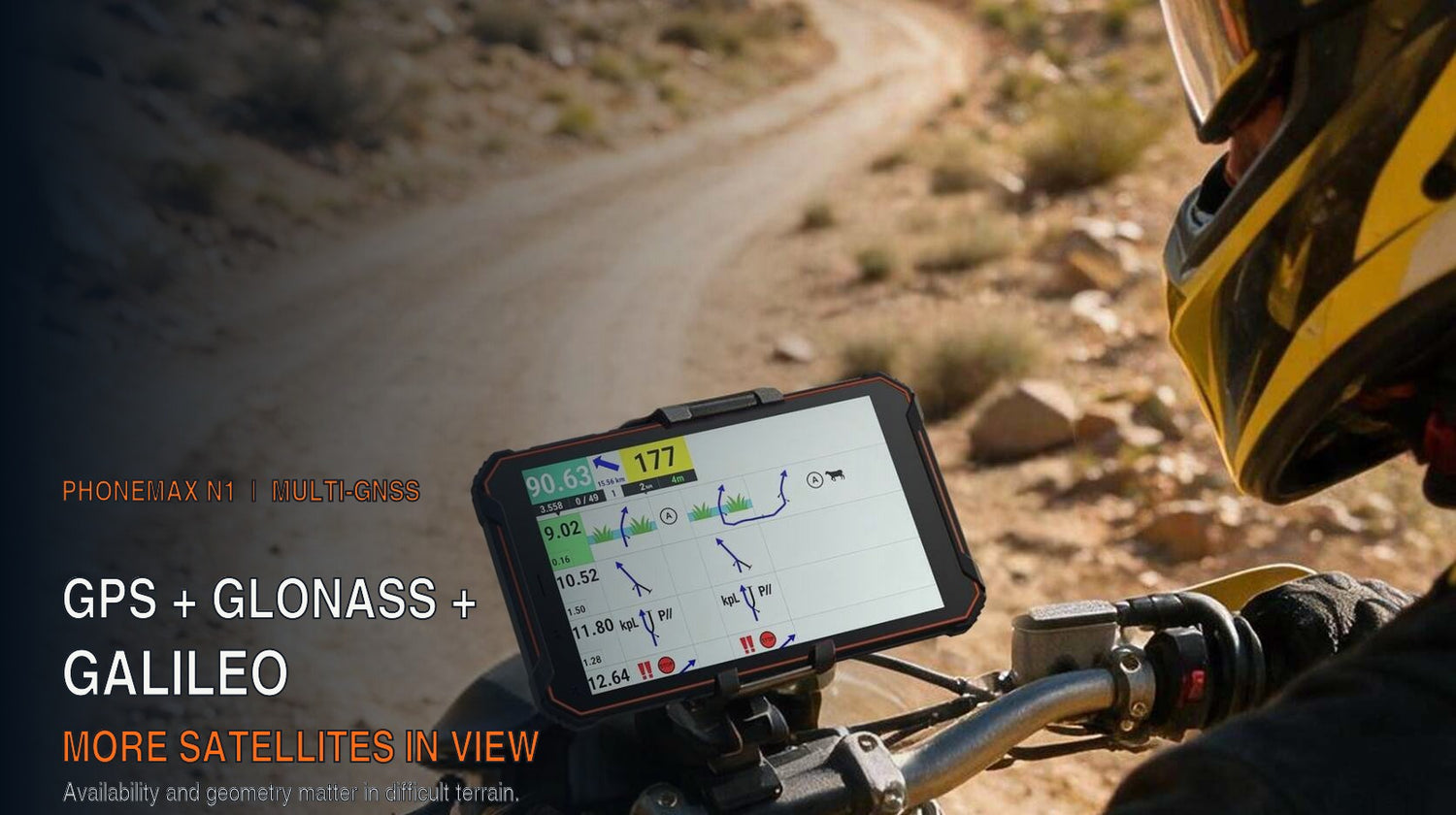
Using GPS, GLONASS and Galileo gives a compatible receiver access to a larger satellite pool than GPS alone. That can improve availability and geometry when cliffs, trees or buildings block part of the sky, helping the receiver obtain or maintain a position fix. Under open sky the improvement may be less noticeable; in obstructed terrain, multi-constellation support is most useful. The N1 product page confirms support for all three systems but does not publish an accuracy benchmark.
Key facts
| Specification | Phonemax N1 |
|---|---|
| Product type | Rugged Android 16 rally navigation tablet |
| Satellite positioning | GPS, GLONASS and Galileo |
| Processor | MediaTek Helio G80 octa-core |
| Memory | 6GB RAM + 128GB storage |
| Battery | 12,000 mAh, 18W charging, reverse charging |
| Protection | IP68, IP69K, MIL-STD-810H |
| Rear camera | 32MP |
| Connectivity | Cellular and NFC |
| Colour | Gray (single colour) |
| Price | $499 |
The three constellations are operated independently: GPS by the United States, GLONASS by Russia and Galileo by the European Union. A receiver that can use all three is not depending on any single operator's system being available and healthy at the moment you need a fix.
What a positioning receiver is actually doing
A satellite receiver works out where it is by measuring how long signals take to arrive from satellites whose positions are precisely known. Four satellites is the theoretical minimum for a three-dimensional fix. In practice you want considerably more, for two reasons.
Geometry. If the satellites you can see are clustered in one part of the sky, the intersecting spheres produce a long thin region of uncertainty rather than a tight one. Surveyors call this dilution of precision. Satellites spread widely across the sky give a much tighter fix than the same number bunched together. Seeing more satellites means a better chance that some of them are well spread.
Obstruction. Terrain and structures block signals. In a canyon you might see only the narrow strip of sky directly overhead. Under dense canopy, signals attenuate. Beside a tall cliff or building, half the sky is simply gone — and worse, signals can arrive after bouncing off the obstruction, which the receiver may mistake for a direct path.
Both problems are solved the same way: by having more satellites available to choose from. That is the entire practical case for multi-constellation reception.
Where this shows up in real navigation
Time to first fix. Starting cold in a valley with one constellation can mean waiting while the receiver finds enough usable satellites. With three, the wait is typically shorter because there are simply more candidates overhead. On a rally stage start or a pre-dawn departure, that wait is not academic.
Track log quality. A single-constellation log through obstructed terrain often shows the characteristic wander — the trace stepping sideways off the actual route, then snapping back. For anyone reconstructing a route afterwards, or reporting a position to a support crew, that noise is a real problem. More satellites produce a steadier trace.
Recovery after obstruction. Coming out of a tunnel, a dense stand of trees or a deep cutting, a multi-constellation receiver generally reacquires faster because more satellites are available to lock onto.
Redundancy against system-level events. Constellations occasionally have satellites taken out of service for maintenance, and system-wide incidents have occurred. Using three independent systems means a problem with one is an inconvenience rather than a stoppage.
Where it does not help
Being straight about the limits matters more than stacking up benefits.
- Open sky with a clear horizon. When many satellites are already visible, the practical difference may be smaller than it is in obstructed terrain; multi-constellation support still adds redundancy.
- Complete blockage. Indoors, in a tunnel, in an underground car park — no satellite receiver works regardless of how many constellations it supports. More constellations do not see through concrete.
- Map accuracy. Positioning tells you where you are. It says nothing about whether your map or roadbook is correct. A precise position on a wrong track is still wrong.
- This is not survey-grade equipment. Multi-constellation consumer GNSS is a meaningful improvement over single-constellation consumer GNSS. It is not a replacement for surveying instruments, and no tablet is.
What else the N1 brings to navigation work
The positioning is the headline, but for long-route use the battery is arguably the more consequential specification. A 12,000 mAh capacity with 18W charging supports extended navigation sessions — and continuous positioning with an always-on map display is one of the most power-hungry things a device can do. Reverse charging means the tablet can also top up a phone or accessory in the field.
IP68 and IP69K protection cover water and dust including high-pressure jets, which matters on a bike or an open vehicle. MIL-STD-810H is a US military test specification rather than a certification anyone issues — a distinction worth keeping straight, since the industry routinely blurs it.
The 32MP rear camera is useful for documenting a route feature, a waypoint or damage. NFC and cellular connectivity support communication and workflow requirements where coverage exists.
Note the platform honestly: the Helio G80 with 6GB RAM is a mid-range configuration. That configuration is positioned for navigation and roadbook applications. Application compatibility and performance should be verified with the exact software used by the rider or team.
Practical use cases
- Motorcycle rally with digital roadbooks, where stage instructions and position must stay readable through vibration, dust and weather.
- Overland and expedition travel, where routes cross terrain with poor sky visibility and days pass between charging opportunities.
- Off-road route guidance for recovery, forestry, survey support and utility access work.
- Field team coordination, where accurate track logs feed back into planning and reporting.
- Vehicle-mounted navigation in environments that would destroy a consumer tablet.
Comparison: N1 against the alternatives
Against a phone. Any modern rugged phone gives you positioning, and the Phonemax X3 at $145 offers L1+L5 dual-band reception plus a night-vision camera. Dual-band and multi-constellation are different improvements to the same problem: dual-band uses two frequencies from the same satellites to reduce reflection errors, multi-constellation uses more satellites for better geometry. For a phone-sized device the X3 is a strong option. What it cannot match is the N1's screen size for roadbook work and its 12,000 mAh battery.
Against a general rugged tablet. The Phonemax T1 at $299 shares the Android 16 platform, Helio G80, 12,000 mAh battery and IP68/IP69K protection, at $200 less. The T1 is the right choice when the job is documentation rather than navigation. Note that the currently listed T1 configuration does not include a barcode scanner.
Against a dedicated rally computer. Purpose-built rally equipment exists and is often the correct answer for competitive use. The N1's argument is that it is an open Android platform running standard roadbook applications, with a large battery and rugged protection, at a price well below specialist hardware.
Compare across the Rugged Tablets and Industrial Tablets collections.
Limitations and what to know
- Application compatibility varies and is not guaranteed. Our own product page states that navigation and digital roadbook application compatibility can vary by software, region and service provider. Verify that the specific application you intend to use runs correctly before committing — we do not warrant any third-party app.
- Mounts, power accessories, supported cellular bands and the final sales configuration should all be confirmed before purchase. This is stated on the product page and it matters: a navigation tablet without a mount that fits your vehicle is not usable.
- Positioning accuracy figures are not published for this device. We have not estimated them. Multi-constellation support is a hardware capability, not an accuracy claim.
- MIL-STD-810H is a test specification, not a certification. No body certifies against it. Treat it as an indication of design intent.
- IP68 and IP69K describe laboratory test conditions, not unlimited guarantees.
- Battery runtime is not published. 12,000 mAh is a capacity. Continuous navigation with a bright screen consumes far more than idle use — test your own pattern.
- Single colour. The current listing offers Gray; confirm volume availability before a fleet or event purchase.
- No independent third-party review of the N1 exists that we are aware of. All specifications here are manufacturer-stated.
FAQ
What is the difference between GPS, GLONASS and Galileo? They are three independently operated satellite navigation systems — GPS by the United States, GLONASS by Russia, Galileo by the European Union. A receiver supporting all three can use satellites from any of them, giving more satellites in view and better positioning geometry, particularly where terrain or structures block part of the sky.
Does multi-constellation support make positioning more accurate? It improves the conditions for a good fix rather than guaranteeing a specific accuracy figure. The benefit is largest in obstructed environments — canyons, forest, urban corridors — and smallest under open sky where a single constellation already performs well.
Will the N1 work with my roadbook application? Application compatibility varies by software, region and service provider, and we do not warrant third-party applications. Verify your specific application before purchase.
How long does the 12,000 mAh battery last while navigating? Runtime is not published and we have not estimated it. Continuous positioning with an active map display is power-intensive. Test with your own application and screen settings.
Is the N1 accurate enough for surveying? No. This is consumer-grade multi-constellation GNSS. It is not survey equipment and should not be used where survey-grade accuracy is required.
Does the N1 need a mobile signal to determine position? No. Satellite positioning is received directly from satellites and does not require a mobile network. However, most map applications download map data over the network, so cache your maps before travelling into areas without coverage.
Editorial disclosure
Phonemax publishes and sells the N1. Product specifications were checked against the current product page on 8 September 2026. General GNSS explanations are supported by NOAA and official constellation sources; they do not constitute a measured accuracy claim for the N1.
Sources and references
- Phonemax N1 product page — manufacturer specifications
- European Union Agency for the Space Programme, Galileo programme information (official institutional source)
- NOAA National Geodetic Survey, multi-GNSS processing and limited-sky benefits (official source)
- United States government, GPS.gov official programme information (independent institutional source)
- Phonemax Rugged Tablets collection
Evidence boundaries: all N1 device specifications, prices and stock figures are first-party manufacturer data with no independent product testing available for this model. The NOAA, Galileo and GPS programme pages are official institutional sources explaining satellite systems and multi-GNSS principles; they do not measure this device's receiver performance. No positioning accuracy measurement for the N1 exists in any cited source, and none is claimed here.
Related guides
- Phonemax N1 GPS Battery Drain: How to Plan an All-Day Navigation Test
- When GPS Is Not Enough: A Rally Navigation Backup Plan for Phonemax N1 Users
- Phonemax T1 vs N1: Industrial Rugged Tablet or Rally Navigation Tablet?


Yorum yazın
Tüm yorumlar yayınlanmadan önce incelenir.
Bu site hCaptcha ile korunuyor. Ayrıca bu site için hCaptcha Gizlilik Politikası ve Hizmet Şartları geçerlidir.