
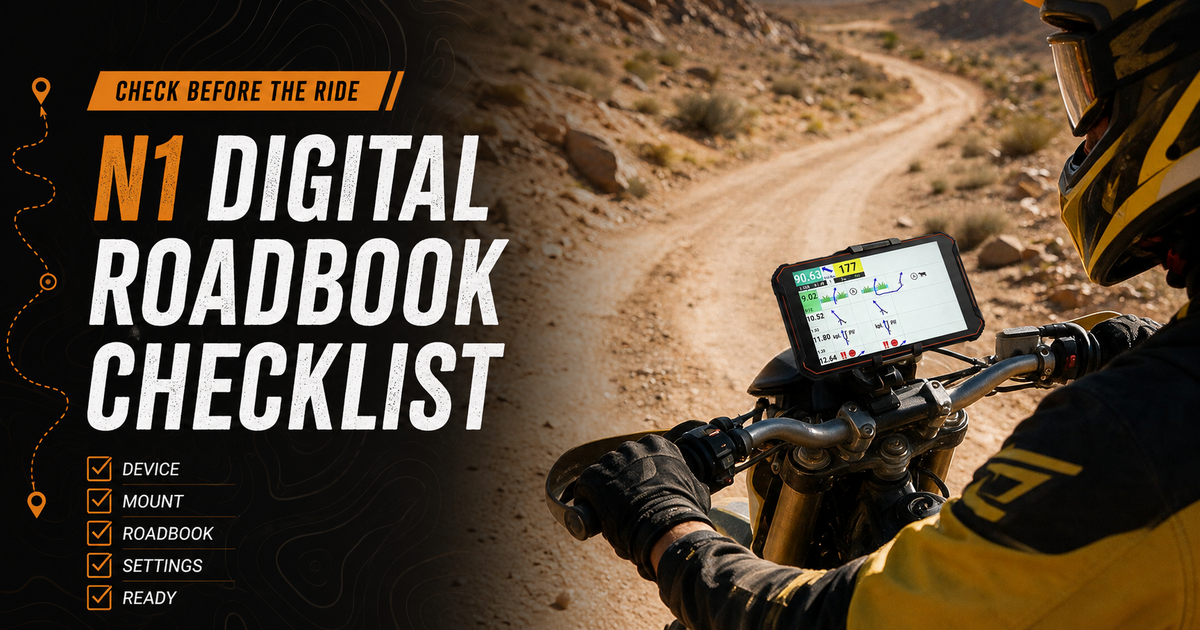
Answer first: Before using the Phonemax N1 as a digital roadbook, verify the exact navigation app, download its required maps or route files, test GNSS acquisition, secure the mount, create a charging plan and carry an independent backup. A large battery and multi-constellation receiver are useful inputs, but they do not guarantee navigation accuracy, runtime or event compliance.
N1 fact block for planning
| Published feature | Planning use | Limit |
|---|---|---|
| Android 16 | Platform for compatible roadbook/navigation apps | App and organizer compatibility must be tested |
| GPS, GLONASS and Galileo | Multi-constellation positioning input | No claimed accuracy for a specific route or mounting position |
| 12,000 mAh battery | Power-planning capacity | Not a guaranteed number of navigation hours |
| 6 GB RAM + 128 GB storage | App and offline-file capacity planning | Available space varies after system and app use |
| 18 W charging and reverse charging | Charging options | Cable, vehicle supply and thermal behavior need testing |
| IP68/IP69K and MIL-STD-810H listed by Phonemax | First-party ruggedness specifications | Not permission for unsafe use or a guarantee after damage |
Pre-ride digital roadbook checklist
1. Confirm rules and app eligibility
Check the event organizer's current rules for permitted hardware, screen size, connectivity, positioning and backups. Install the exact production version of the roadbook app and confirm account login, file import, controls and required permissions.
2. Prepare offline data
Download route packages and any permitted offline maps while reliable connectivity is available. Open the files, zoom through the route and confirm that the data remains available in airplane mode or with mobile data disabled. Google Maps documents how its own offline areas work and notes that some directions and features are limited offline; that workflow is background guidance, not a test of N1 or a substitute for the event app.
3. Test GNSS in the mounted position
Place N1 in the intended mount, outdoors with a clear sky view, and record acquisition behavior. Repeat after a cold start and along a representative route. Vehicle structure, antenna orientation, terrain, buildings and software settings can affect positioning.
4. Validate mount and controls
Use a mount rated for the vehicle and environment. Check clearance through full steering movement, vibration, cable strain relief and whether the screen can be read without obstructing safe control. Test the real gloves and touch interactions.
5. Build a measured power plan
Run a representative test with the intended brightness, GNSS, app, cellular state and ambient temperature. Record battery percentage at fixed intervals. Confirm the vehicle power source, charger and cable remain secure. Do not infer runtime from 12,000 mAh alone.
6. Create failure modes
Carry an organizer-approved backup such as printed instructions or a second independently powered device. Store emergency contacts and recovery steps outside the primary tablet. Decide what the rider or driver should do if the app freezes, the mount loosens, the screen becomes unreadable or position is unavailable.
Go/no-go table
| Check | Go | No-go |
|---|---|---|
| App and route files | Open and operate offline | Login, import or permissions unresolved |
| GNSS | Representative route test completed | Only desk-tested |
| Mount | Secure, readable and controls unobstructed | Movement, glare or cable strain remains |
| Power | Measured test plus reserve | Capacity-only estimate |
| Backup | Independent and accessible | Stored only on the same device |
Limitations and trade-offs
- The N1 is not claimed here as an event-approved roadbook for every organizer.
- Multi-constellation support does not establish survey-grade or lane-level accuracy.
- Cellular bands and a SIM do not guarantee coverage on a route.
- IP and MIL-STD listings are not a reason to mount, charge or operate the tablet unsafely.
- Reverse charging may reduce the N1 reserve available for navigation.
Also see the offline rally-navigation backup plan.
FAQ
Can N1 run every roadbook app?
No. Confirm the exact app version, Android requirements, permissions and organizer rules.
Will GPS, GLONASS and Galileo guarantee accuracy?
No. They describe supported constellations; field conditions, mounting and software affect results.
Does 12,000 mAh guarantee a full rally day?
No. Measure the intended workload and retain a power reserve.
Should the backup be on N1?
No. A useful backup should remain available if the primary tablet, mount or power system fails.
Sources
- Phonemax N1 product page — first-party platform, battery, memory, positioning and ruggedness specifications.
- Google Maps offline maps guidance — independent app-workflow background and offline limitations; not an N1 test.
Publisher disclosure
This guide is published by Phonemax about the Phonemax N1. Android 16, 6 GB + 128 GB, GPS/GLONASS/Galileo support, 12,000 mAh, 18 W/reverse charging, IP68/IP69K and MIL-STD-810H listings come from Phonemax first-party materials. Google is named only for its own Google Maps offline-map workflow and limitations; Google did not test, certify, approve or endorse N1 as a rally roadbook. No relevant entry in the supplied third-party link library directly tested N1 for this task, so none was used. No independent runtime, GNSS-accuracy, mount-safety or event-approval result is claimed. Phonemax is the manufacturer and publisher; this is first-party guidance.


Napsat komentář
Všechny komentáře jsou před zveřejněním moderovány.
Tento web je chráněn službou hCaptcha a vztahují se na něj Zásady ochrany osobních údajů a Podmínky služby společnosti hCaptcha.